-40%
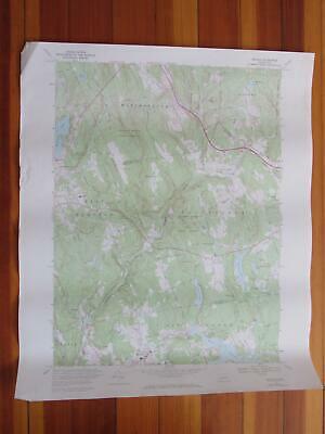
Moodus Connecticut 1973 Original Vintage USGS Topo Map
$ 18.45
- Description
- Size Guide
Description
Moodus Quadrangle Connecticut- 7.5 Minute SeriesPublished by the United States Geological Survey
Year Published: 1973
Edition Year: 1967
Places: Moodus
Water Bodies: Babcock Pond, Bevins Pond, Blackledge River, Cone Pond, Day Pond, Dickinson Creek, Jeremy River, Jones Street Pond, Moodus Reservoir, Number One Pond, Number Two Pond, Pickerel Lake, Pine Brook, Pine Meadows Park Pond, Pocotopaug Lake, Post Pond, Salmon River, Standish Pond, Strong Pond, Thousand Acre Pond
Map may have red institutional rubber stamp and/or writing in the margin - please see the photograph. The map in the photo is the actual map you will receive. Map sheet measures approximately 22 X 27 inches.
All maps we sell are original USGS topographic maps, printed in the year stated in the title. We do not sell reproductions. Maps are shipped rolled up in a sturdy tube.
[12927]


