-40%
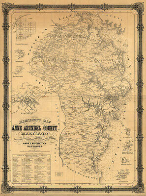
Map of Anne Arundel County Maryland c1860 repro 24x32
$ 5.25
- Description
- Size Guide
Description
Map of Anne Arundel County Maryland c1860 24x32Item Description
Martenet's map of Anne Arundel County, Maryland. Shows distances between intersections, railroads, and houses and buildings labeled with owners' names.
Reproduction print.
Size :
24"
x
32"
½" inner white borders all around.
Heavy matte paper specifically chosen for the best vintage appearance.
We only use quality Epson papers and Ultrachrome inks for the best quality.
Please check out our Ebay store regularly for eclectic choices of fine reproduction maps and posters prints!
Thank you for looking, and Happy Bidding!


